The special program My Family and My Country of CCTV News Channel has an exclusive interview with Li Deren, the chief scientist of Leader Space, an academician of the CAS Member and the CAE Member. Academician Li Deren has led a fundamental transformation from traditional surveying and mapping to information-based surveying and remote sensing in China. Under the leadership of Academician Li Deren and founder Guo Sheng, Lide Space has become the inventor of China's mobile measurement system and a world leading enterprise, receiving high praise and strategic cooperation from many well-known domestic and foreign enterprises.
Next, let's explore the patriotism of Academician Li Deren's lifelong dedication to scientific research and national service through the program 'My Family, My Country'.
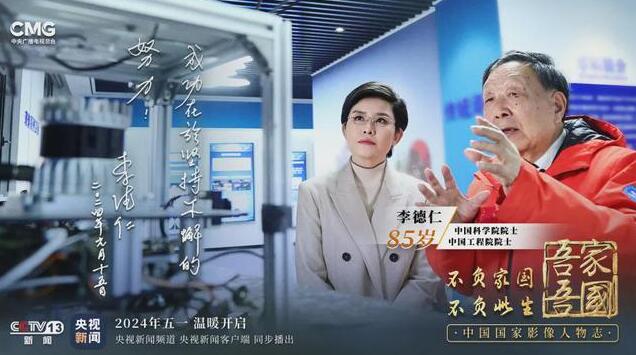
The picture shows the product display of Lide Space at Wuhan University during an interview with Academician Li, from left to right
In the State Key Laboratory of Surveying, Mapping and Remote Sensing of Wuhan University, Academician Li Deren told CCTV host Wang Ning and the teachers and students present about the progress of the "Oriental Insight" project. Academician Li Deren pointed out that the Eastern Insight is the wise eye that was sent to the sky by the Chinese people. The basis of "Dongfang Huiyan" is the "Luojia-3 Satellite 01" launched in 2023. If there are 200 such satellites, remote sensing information can be obtained within five minutes, and if there are 300, the time can be shortened to three minutes. According to Academician Li Deren's plan, by 2030, the entire constellation will have more than 200 satellites in orbit, achieving integrated communication, navigation, and remote sensing, and interconnected sky and earth networks.
As the vanguard of the "Oriental Insight" project, "Luojia No.3 Satellite 01" is the world's first Internet intelligent remote sensing satellite. Like the Luojia-3 satellite, the Luojia-1 and Luojia-2 satellites are both scientific experimental satellites. In the summer of 2023, during flood control and disaster relief in Hebei Province, the water conservancy department discovered the hidden danger of dam breaches through radar images captured by the Luojia-2 satellite, and more than 6000 people were safely evacuated as a result. This reflects the advantages of radar remote sensing - achieving engineering level applications 24/7.
My 50 years, my life's work, has been to digitize, intelligentize, automate, and real-time the process of surveying and mapping. Academician Li Deren often describes his journey of non-stop thinking and innovation, from carrying machine measurements through mountains and rivers, to aerial remote sensing and satellite remote sensing. The field of surveying, mapping, and remote sensing is rapidly changing with the iteration of technology.
In 1957, 18-year-old Li Deren graduated from high school and passed the entrance examination from Jiangsu to Hubei. Originally intending to study rockets and apply for the Mathematics Department, he was unexpectedly admitted to the newly established Wuhan Institute of Surveying and Mapping, majoring in Aerial Photogrammetry.
How did you finally not regret this at that time?
Our principal, Academician Xia Jianbai, spoke to us from the balcony on the second floor of the principal's office, saying that surveying is very important. To understand natural and human activities on Earth, we first need a map.
At the entrance of the Surveying and Mapping Laboratory at Wuhan University, there stands a statue of Li Deren's mentor Wang Zhizhuo. Wang Zhizhuo, along with Xia Jianbai and Chen Yongling, are known as the founders of Chinese surveying. They comprehensively grasped geodetic, astronomical, and photogrammetric surveying, improving the situation of China's surveying lagging behind at that time.
Academician Li Deren still vividly remembers his acquaintance with his mentor Wang Zhizhuo. During his studies, he discovered several errors in Soviet textbooks and wrote three academic articles to explain them. He then asked his classmates to forward them to Wang Zhizhuo. To Li Deren's surprise, Wang Zhizhuo, who was then the department head, invited him to his home to discuss the three articles written by Li Deren until late at night.
In 1978, the country resumed the graduate entrance examination, and 39 year old Li Deren was admitted to Wang Zhizhuo's graduate program as he wished. Three years later, Academician Li Deren obtained a master's degree with excellent grades and stood at the forefront of the Chinese surveying and mapping community.
In 1982, Academician Li Deren was given the opportunity to study and exchange in the Federal Republic of Germany. With the recommendation of Wang Zhizhuo, he studied under the internationally renowned photogrammetry and remote sensing expert Professor Ackermann. At that time, Ackermann presented him with a highly challenging problem in the field of aerial surveying.